

GPS Tips and Tricks for Travel Photography
How to Add Location Data to Your Pictures

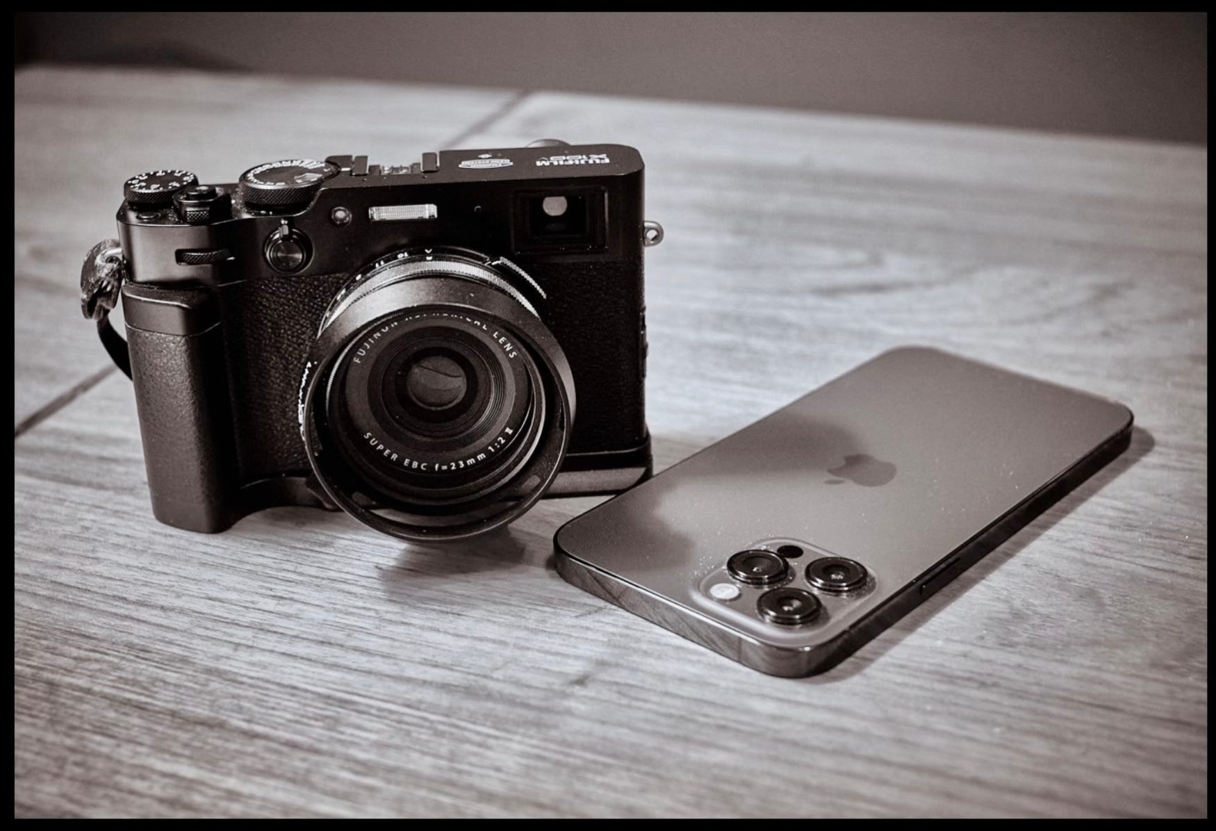
The easiest way to know where you took a picture is to use your smartphone. They automatically add location data to every shot you take. And if we lived by smartphones alone, end of story.
But some of us like interchangeable lens cameras, too. And if you, like me, enjoy the versatility and creativity that come with them, then you might want to have those images geotagged (especially for travel). Here are a few tips for doing that.
Add One Smartphone Photo to Each Location
Image apps like Photos for macOS allow you to copy location data from one picture and apply it to another. So before you move to the next spot, take a smartphone snap and include it in the same batch as your camera pictures.
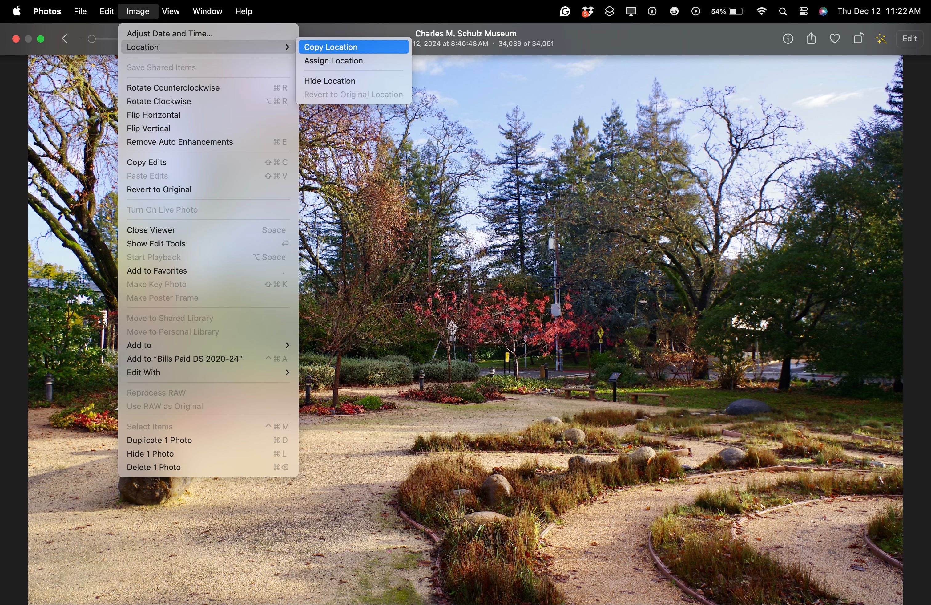
Copy the location information from the iPhone shot, then assign it to the other images in the shoot that you took with your interchangeable lens camera.
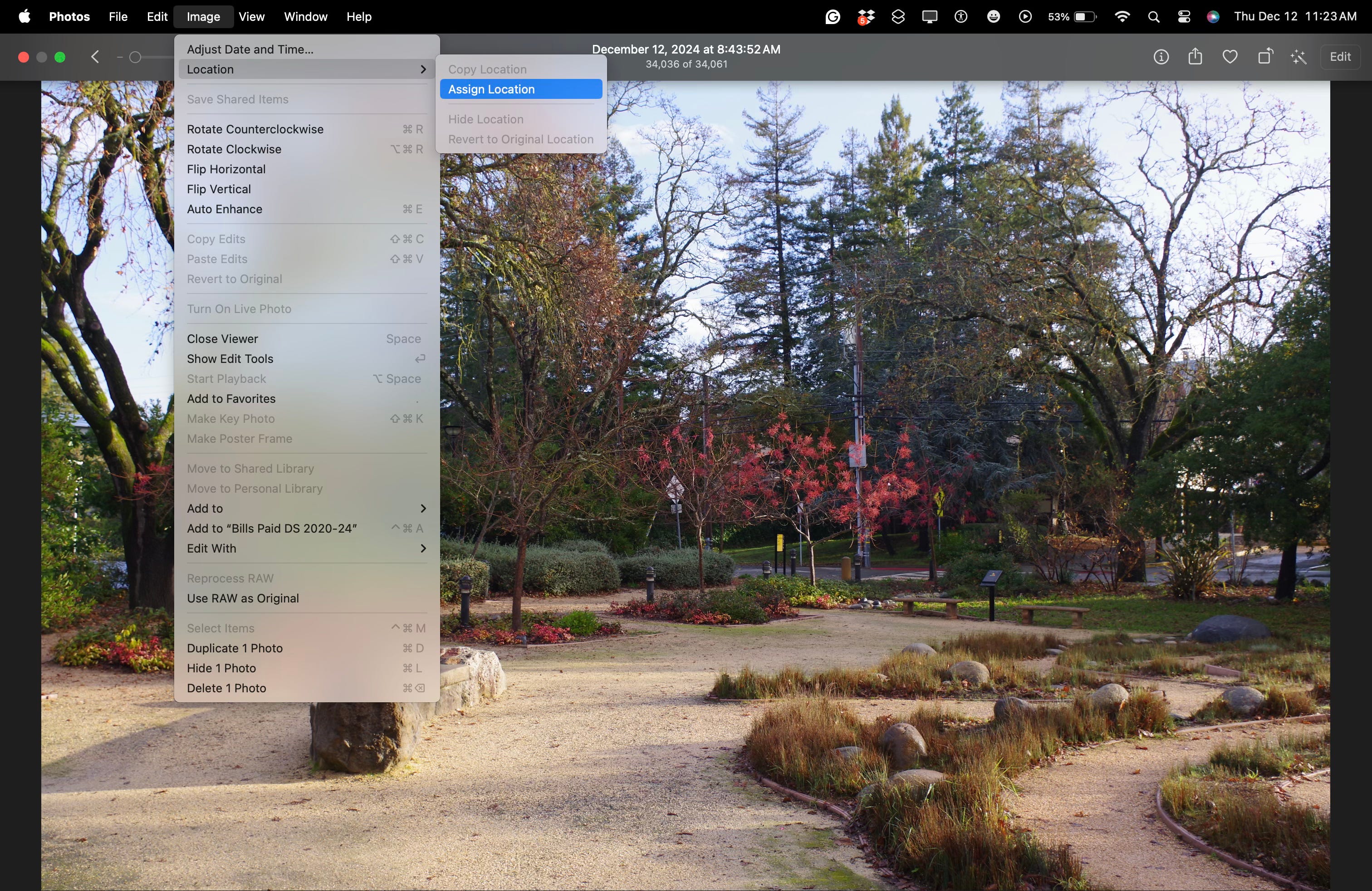
Now you have location information for all the images in that shoot.
Have the Smartphone Send Geotags to Your Camera
Every mirrorless camera has a companion smartphone app. One of the functions that tandem can provide is to allow you to geotag your photos on the camera using the location data from your phone.
Some apps work better than others for this. I’ve had great luck with the Fujifilm X app and my X100V. Pretty good luck with the Nikon Zf and Snapbridge. And difficulties with the Olympus OM-1 and its O.I. Share program.
Test at home before you hit the road to find out if this is a feasible option for you. And you might want to bring an extra battery, just in case. The Bluetooth connection does draw some juice.
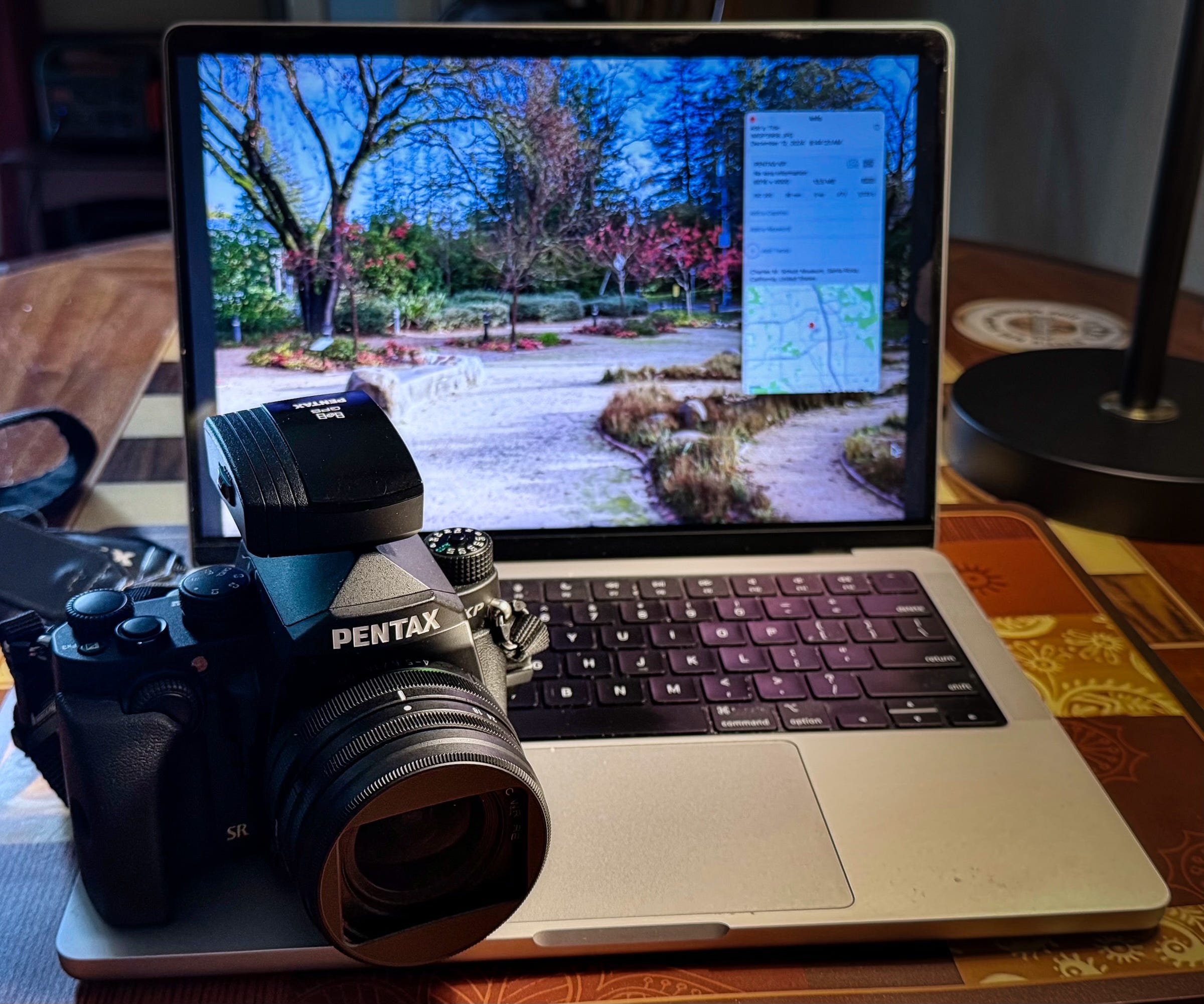
Use a Hotshoe GPS Receiver
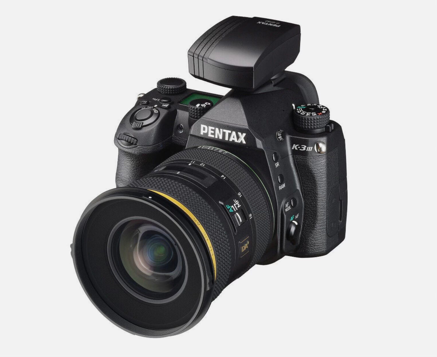
These were common options for DSLR cameras. Receivers were made for practically every brand. I write about this approach in the article titled, GPS Receivers Seem to Have Gone the Way of the DSLR.
The great thing about this option is that the receiver has its own battery, so the radio inside doesn’t draw power from the camera. And your iPhone isn’t in the loop, so none of its juice is used either.
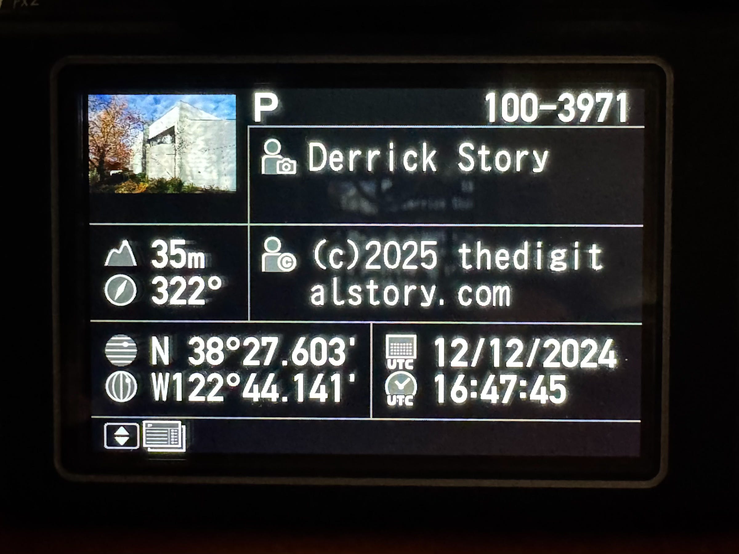
The GPS receiver sends information through the hotshoe contacts to the camera where it writes the coordinates for every picture captured. You can review all of it on the camera’s LCD screen, as shown above.
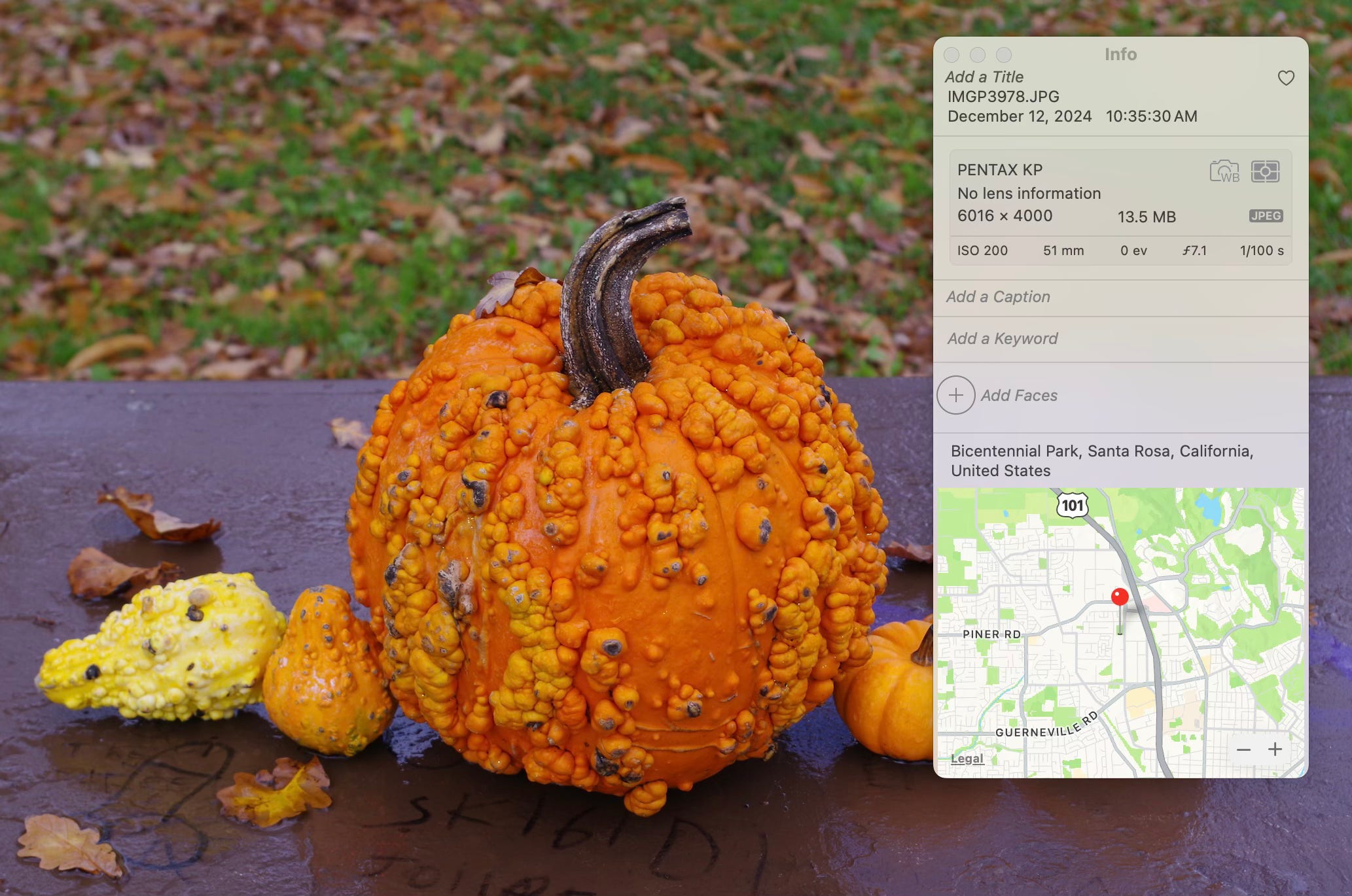
With my Pentax, I get altitude, direction, longitude, latitude, and UTC time and date. The software on the computer takes all of that and places a pin on the map with the location name.
If you’re not already using the hotshoe for a flash, why not put it to work with a GPS receiver? That is, if you still have a DSLR in your possession.
Final Thoughts
I like knowing where my pictures were taken. Even though I might remember the general location for each of my travel pictures, having a pin on a map is even better. Plus, I can use that data to help organize my photo library.
I use all three methods discussed here, depending on the camera I’m using at the moment.
Think about your options before you head out the door for your next trip.